Tatchu Peninsula Trail Hiking Map

Topographical maps to popular west coast trails on Vancouver Island's outer fringe.
Available maps include: Nootka Island, North Coast Trail, Hesquiat Peninsula and Tatchu Peninsula.
• scale 1:50,000
• contour interval 100ft
• full colour map & graphics
• waterproof and tearproof
Tatchu Peninsula
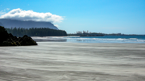
The Tatchu Peninsula is a promontory of Vancouver Island bounded by Esperanza Inlet to its south and Kyuquot Channel to the north. Tatchu is found on the coastal hiker’s map as the next significant stretch of coast to the north of Nootka Island.

The Kyuquot Channel end of this part of the Island’s coast is well known for Rugged Point Provincial Park, and the bustling logging camp at Port Eliza marks the south terminus of the peninsula and the hike along its shore. The ravages of the logging along the beaches and on the hillsides above have been somewhat healed by the maturing second growth forest and, happily, the industrial activity in the area does little to diminish the beauty of the Tatchu Peninsula.
A complex maze of offshore rocks and reefs protects much of the shoreline from the full fury of the Pacific Ocean, and sea otters, bears and other wildlife thrive in this unique ecosystem. The diversity of the beaches from black pebbles to shimmering white sand, interesting geology in the small cliffs and extensive rock shelves and the sense of pioneering on this until now overlooked shoreline are just some of the highlights of the Tatchu coast.
The name Tatchu comes from an old Ehattisat word ‘Tatchtatcha’, which means ‘to chew’ and refers to the abundance of food in the area.

Tatchu Peninsula
A topographic route map for hiking along the shoreline of the Tatchu Peninsula from Yellow Bluff to Rugged Point on the west coast of Vancouver Island, BC. 24"x18" full colour printed on waterproof-tearproof paper. Shows hiking route outline, suggested camps, cautions, highlights and other points of interest.
ISBN 978-0-9691550-4-1
$22.95
shipping, packaging and tax added at checkout.
IMPORTANT - International Orders
For shipping outside of Canada please choose from the following shipping surcharge options to cover costs of shipping internatioanlly.
Prices include shipping & packaging.
Check out our complete catalogue and ordering information. Other future titles and coming new editions.


